Climate - Blog Posts
Solar System: 10 Things to Know This Week
The Living Planet Edition
Whether it's crops, forests or phytoplankton blooms in the ocean, our scientists are tracking life on Earth. Just as satellites help researchers study the atmosphere, rainfall and other physical characteristics of the planet, the ever-improving view from above allows them to study Earth's interconnected life.
1. Life on Earth, From Space

While we (NASA) began monitoring life on land in the 1970s with the Landsat satellites, this fall marks 20 years since we've continuously observed all the plant life at the surface of both the land and ocean. The above animation captures the entirety of two decades of observations.
2. Watching the World Breathe
With the right tools, we can see Earth breathe. With early weather satellite data in the 1970s and '80s, NASA Goddard scientist Compton Tucker was able to see plants' greening and die-back from space. He developed a way of comparing satellite data in two wavelengths.

When healthy plants are stocked with chlorophyll and ready to photosynthesize to make food (and absorb carbon dioxide), leaves absorb red light but reflect infrared light back into space. By comparing the ratio of red to infrared light, Tucker and his colleagues could quantify vegetation covering the land.
Expanding the study to the rest of the globe, the scientists could track rainy and dry seasons in Africa, see the springtime blooms in North America, and wildfires scorching forests worldwide.
3. Like Breathing? Thank Earth's Ocean

But land is only part of the story. The ocean is home to 95 percent of Earth's living space, covering 70 percent of the planet and stretching miles deep. At the base of the ocean's food web is phytoplankton - tiny plants that also undergo photosynthesis to turn nutrients and carbon dioxide into sugar and oxygen. Phytoplankton not only feed the rest of ocean life, they absorb carbon dioxide - and produce about half the oxygen we breathe.

In the Arctic Ocean, an explosion of phytoplankton indicates change. As seasonal sea ice melts, warming waters and more sunlight will trigger a sudden, massive phytoplankton bloom that feeds birds, sea lions and newly-hatched fish. But with warming atmospheric temperatures, that bloom is now happening several weeks earlier - before the animals are in place to take advantage of it.
4. Keeping an Eye on Crops
The "greenness" measurement that scientists use to measure forests and grasslands can also be used to monitor the health of agricultural fields. By the 1980s, food security analysts were approaching NASA to see how satellite images could help with the Famine Early Warning System to identify regions at risk - a partnership that continues today.

With rainfall estimates, vegetation measurements, as well as the recent addition of soil moisture information, our scientists can help organizations like USAID direct emergency help.
The view from space can also help improve agricultural practices. A winery in California, for example, uses individual pixels of Landsat data to determine when to irrigate and how much water to use.
5. Coming Soon to the International Space Station

A laser-based instrument being developed for the International Space Station will provide a unique 3-D view of Earth's forests. The instrument, called GEDI, will be the first to systematically probe the depths of the forests from space.

Another ISS instrument in development, ECOSTRESS, will study how effectively plants use water. That knowledge provided on a global scale from space will tell us "which plants are going to live or die in a future world of greater droughts," said Josh Fisher, a research scientist at NASA's Jet Propulsion Laboratory and science lead for ECOSTRESS.
6. Seeing Life, From the Microscopic to Multicellular
Scientists have used our vantage from space to study changes in animal habitats, track disease outbreaks, monitor forests and even help discover a new species. Bacteria, plants, land animals, sea creatures and birds reveal a changing world.

Our Black Marble image provides a unique view of human activity. Looking at trends in our lights at night, scientists can study how cities develop over time, how lighting and activity changes during certain seasons and holidays, and even aid emergency responders during power outages caused by natural disasters.
7. Earth as Analog and Proving Ground
Just as our Mars rovers were tested in Earth's deserts, the search for life on ocean moons in our solar system is being refined by experiments here. JPL research scientist Morgan Cable looks for life on the moons of Jupiter and Saturn. She cites satellite observations of Arctic and Antarctic ice fields that are informing the planning for a future mission to Europa, an icy moon of Jupiter.

The Earth observations help researchers find ways to date the origin of jumbled, chaotic ice. "When we visit Europa, we want to go to very young places, where material from that ocean is being expressed on the surface," she explained. "Anywhere like that, the chances of finding biomarkers goes up - if they're there."
8. Only One Living Planet
Today, we know of only one living planet: our own. The knowledge and tools NASA developed to study life here are among our greatest assets as we begin the search for life beyond Earth.

There are two main questions: With so many places to look, how can we home in on the places most likely to harbor life? What are the unmistakable signs of life - even if it comes in a form we don't fully understand? In this early phase of the search, "We have to go with the only kind of life we know," said Tony del Genio, co-lead of a new NASA interdisciplinary initiative to search for life on other worlds.

So, the focus is on liquid water. Even bacteria around deep-sea vents that don't need sunlight to live need water. That one necessity rules out many planets that are too close or too far from their stars for water to exist, or too far from us to tell. Our Galileo and Cassini missions revealed that some moons of Jupiter and Saturn are not the dead rocks astronomers had assumed, but appear to have some conditions needed for life beneath icy surfaces.
9. Looking for Life Beyond Our Solar System
In the exoplanet (planets outside our solar system that orbit another star) world, it's possible to calculate the range of distances for any star where orbiting planets could have liquid water. This is called the star's habitable zone. Astronomers have already located some habitable-zone planets, and research scientist Andrew Rushby of NASA Ames Research Center is researching ways to refine the search. "An alien would spot three planets in our solar system in the habitable zone [Earth, Mars and Venus]," Rushby said, "but we know that 67 percent of those planets are not inhabited."

He recently developed a model of Earth's carbon cycle and combined it with other tools to study which planets in habitable zones would be the best targets to look for life, considering probable tectonic activity and water cycles. He found that larger planets are more likely than smaller ones to have surface temperatures conducive to liquid water. Other exoplanet researchers are looking for rocky worlds, and biosignatures, the chemical signs of life.
10. You Can Learn a Lot from a Dot
When humans start collecting direct images of exoplanets, even the closest ones will appear as only a handful of pixels in the detector - something like the famous "blue dot" image of Earth from Saturn. What can we learn about life on these planets from a single dot?

Stephen Kane of the University of California, Riverside, has come up with a way to answer that question by using our EPIC camera on NOAA's DSCOVR satellite. "I'm taking these glorious pictures and collapsing them down to a single pixel or handful of pixels," Kane explained. He runs the light through a noise filter that attempts to simulate the interference expected from an exoplanet mission. By observing how the brightness of Earth changes when mostly land is in view compared with mostly water, Kane reverse-engineers Earth's rotation rate - something that has yet to be measured directly for exoplanets.
The most universal, most profound question about any unknown world is whether it harbors life. The quest to find life beyond Earth is just beginning, but it will be informed by the study of our own living planet.
Make sure to follow us on Tumblr for your regular dose of space: http://nasa.tumblr.com.
Pinpointing the Cause of Earth’s Recent Record CO2 Spike
A new NASA study provides space-based evidence that Earth’s tropical regions were the cause of the largest annual increases in atmospheric carbon dioxide concentration seen in at least 2,000 years.
What was the cause of this?
Scientists suspect that the 2015-2016 El Niño – one of the largest on record – was responsible. El Niño is a cyclical warming pattern of ocean circulation in the Pacific Ocean that affects weather all over the world. Before OCO-2, we didn’t have enough data to understand exactly how El Nino played a part.

Analyzing the first 28 months of data from our Orbiting Carbon Observatory (OCO-2) satellite, researchers conclude that impacts of El Niño-related heat and drought occurring in the tropical regions of South America, Africa and Indonesia were responsible for the record spike in global carbon dioxide.

These three tropical regions released 2.5 gigatons more carbon into the atmosphere than they did in 2011. This extra carbon dioxide explains the difference in atmospheric carbon dioxide growth rates between 2011 and the peak years of 2015-16.

In 2015 and 2016, OCO-2 recorded atmospheric carbon dioxide increases that were 50% larger than the average increase seen in recent years preceding these observations.

In eastern and southern tropical South America, including the Amazon rainforest, severe drought spurred by El Niño made 2015 the driest year in the past 30 years. Temperatures were also higher than normal. These drier and hotter conditions stressed vegetation and reduced photosynthesis, meaning trees and plants absorbed less carbon from the atmosphere. The effect was to increase the net amount of carbon released into the atmosphere.

In contrast, rainfall in tropical Africa was at normal levels, but ecosystems endured hotter-than-normal temperatures. Dead trees and plants decomposed more, resulting in more carbon being released into the atmosphere.

Meanwhile, tropical Asia had the second-driest year in the past 30 years. Its increased carbon release, primarily from Indonesia, was mainly due to increased peat and forest fires - also measured by satellites.

We knew El Niños were one factor in these variations, but until now we didn’t understand, at the scale of these regions, what the most important processes were. OCO-2’s geographic coverage and data density are allowing us to study each region separately.
Why does the amount of carbon dioxide in our atmosphere matter?
The concentration of carbon dioxide in Earth’s atmosphere is constantly changing. It changes from season to season as plants grow and die, with higher concentrations in the winter and lower amounts in the summer. Annually averaged atmospheric carbon dioxide concentrations have generally increased year over year since the 1800s – the start of the widespread Industrial Revolution. Before then, Earth’s atmosphere naturally contained about 595 gigatons of carbon in the form of carbon dioxide. Currently, that number is 850 gigatons.

Carbon dioxide is a greenhouse gas, which means that it can trap heat. Since greenhouse gas is the principal human-produced driver of climate change, better understanding how it moves through the Earth system at regional scales and how it changes over time are important aspects to monitor.

Get more information about these data HERE.
Make sure to follow us on Tumblr for your regular dose of space: http://nasa.tumblr.com.
Tracking a Warming Arctic – From Underground to High in the Sky
The Arctic is warming much faster than the rest of Earth. This warming is creating big and small changes, some of which could ripple beyond the planet’s frozen regions and affect us world-wide – possibly raising sea levels, increasing greenhouse warming and affecting wildlife.
Our Arctic Boreal Vulnerability Experiment, known as ABoVE, just began a 10-year mission in Alaska and western Canada, studying these changes.
Underground: Permafrost is the layer of frozen soil beneath some Arctic forests and tundra.

Like the name suggests, this icy layer stays solid year-round, so when it does melt, it can create big problems. The soil above the thawing permafrost can collapse, creating this wobbly, unstable surface.
7 feet above sea level: As the permafrost thaws, the soil above it can fall away.

Along the banks of the Itkillik River in Alaska, thawing permafrost has dripped into the water, eroding the cliff side. Known as the “Stinky Bluffs,” this permafrost contains lots of frozen organic matter from dead plants and animals. As the permafrost thaws, this organic matter doesn’t just smell, it also releases carbon dioxide and methane into the atmosphere, adding to the warming effect.
446 feet above sea level: Wildfires aren’t unusual in the forests and shrub lands of Alaska, but as the climate continues to warm, they burn longer and do more damage.

People who live off the land in the region help researchers understand where plant life isn’t growing back after fires.
100-1000 feet above sea level: Researchers set up 100-foot tall towers at strategic locations throughout Alaska to measure carbon dioxide and methane emissions from right above the forest canopy.

This provides an up-close look at what gases are released or absorbed from the trees, or swirl in from neighboring regions. These data are combined with measurements taken from airplanes and satellites to create a clearer picture of how much carbon is entering the atmosphere.
3,369 feet above sea level: Dall sheep live in several Alaskan mountain ranges, where they’re critical to both the tourism and sports hunting economies.

Credit: National Park Service
Changes in temperature and vegetation can profoundly affect their behavior, like grazing habits, and so researchers study how changing plant life and snow cover affect the sheep.
100-30,000 feet above sea level: Carbon emissions in the air come from thawing permafrost, fossil fuel burning, decaying vegetation and wildfires burning across the Arctic-boreal regions.

One experiment in the ABoVE campaign measures these emissions with instruments on a DC-8 plane.
About 30,000 feet about sea level: When wildfires burn through vegetation, the effects extend far beyond what we see on the ground.

Fires release carbon stored in the plants into the atmosphere, where it affects air quality and contributes to the greenhouse effect.
438 miles: Our ABoVE campaign combines research on the ground and from planes with data collected by a fleet of Earth-observing satellites, orbiting Earth hundreds of miles above the surface.

Data from these satellites provides information on vegetation, atmospheric particles and gasses, and how humans are impacting our planet. With all these data sets analyzed by computer programs, the result is a comprehensive picture of our warming planet.
Make sure to follow us on Tumblr for your regular dose of space: http://nasa.tumblr.com
2016 Sets Global Temperature Record
We just experienced the hottest year on record…again.

2016 was hotter than 2015, the previous record. And 2015 hotter than 2014, the previous record year.
These record temperatures are all part of a warming trend that dates back to the late-19th century, largely caused by human emissions of carbon dioxide and other gases into the atmosphere.

A lot of this warming trend has been in the last 35 years. In fact, 16 of the 17 warmest years on record have been since 2001.
To help us gather this data, planes and boats travel out from Antarctic research stations to gather information from the Arctic region, in addition to space-based observatories.
Scientists at our Goddard Institute for Space Studies analyze data from 6,300 weather stations, observations of sea surface temperature and Antarctic research stations, all to determine how the average surface temperature is changing.

Scientists at the National Oceanic and Atmospheric Administration separately analyze the same data to track global temperature.
The two agencies reached the same conclusion about 2016’s record-setting heat.
Variations in local weather mean parts of the globe did not experience a record-setting year. Some places still had snow, cold weather and below-record temperatures, but the overall global average was higher than any previous year.

For instance, according to NOAA the average temperature in the 48 contiguous United States was not quite as high as in 2015, which still holds the record.

A combination of space- and land-based measurements gives us a unique perspective on Earth, the only planet we know of that supports life.
To learn more about the global temperature record or see how average surface temperature for individual months, visit: http://data.giss.nasa.gov/gistemp/
Make sure to follow us on Tumblr for your regular dose of space: http://nasa.tumblr.com
Why Do We Study Ice?
Discover why we study ice and how this research benefits Earth.

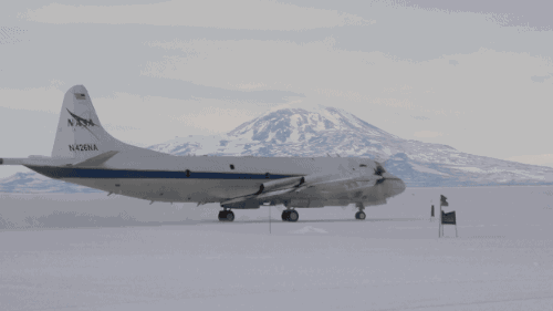
We fly our DC-8 aircraft very low over Antarctica as part of Operation IceBridge – a mission that’s conducting the largest-ever airborne survey of Earth’s polar ice.

Records show that 2015 was the warmest year on record, and this heat affects the Arctic and Antarctica – areas that serve as a kind of air conditioner for Earth and hold an enormous of water.

IceBridge flies over both Greenland and Antarctica to measure how the ice in these areas is changing, in part because of rising average global temperatures.
IceBridge’s data has shown that most of Antarctica’s ice loss is occurring in the western region. All that melting ice flows into the ocean, contributing to sea level rise.

IceBridge has been flying the same routes since the mission began in 2009. Data from the flights help scientists better measure year-to-year changes.

IceBridge carries the most sophisticated snow and ice instruments ever flown. Its main instrument is called the Airborne Topographic Mapper, or ATM.The ATM laser measure changes in the height of the ice surface by measuring the time it takes for laser light to bounce off the ice and return to the plane – ultimately mapping ice in great detail, like in this image of Antarctica's Crane Glacier.

For the sake of the laser, IceBridge planes have to fly very low over the surface of snow and ice, sometimes as low as 1,000 feet above the ground. For comparison, commercial flights usually stay around 30,000 feet! Two pilots and a flight enginner manage the many details involved in each 10- to 12-hour flight.

One of the scientific radars that fly aboard IceBridge helped the British Antarctic Survey create this view of what Antarctica would look like without any ice.

IceBridge also studies gravity using a very sensitive instrument that can measure minuscule gravitational changes, allowing scientists to map the ocean cavities underneath the ice edges of Antarctica. This data is essential for understanding how the ice and the ocean interact. The instrument’s detectors are very sensitive to cold, so we bundle it up to keep it warm!

Though the ice sheet of Antarctica is two miles thick in places, the ice still “flows” – faster in some places and slower in others. IceBridge data helps us track how much glaciers change from year-to-year.

Why do we call this mission IceBridge? It is bridging the gap between our Ice, Cloud and Land Elevation Satellite, or ICESat – which gathered data from 2003 to 2009 – and ICESat-2, which will launch in 2018.

Learn more about our IceBridge mission here: www.nasa.gov/icebridge and about all of our ice missions on Twitter at @NASA_Ice.
Make sure to follow us on Tumblr for your regular dose of space: http://nasa.tumblr.com
GOES-R: The Future of Forecasting

What is GOES-R?
The Geostationary Operational Environmental Satellite-R Series (GOES-R) is the nation’s next generation of geostationary weather satellites. It is the first of four satellites to be launched for the National Oceanic and Atmospheric Administration (NOAA).
The GOES-R satellite will provide advanced imaging with increased spatial resolution and faster coverage for more accurate forecasts, real-time mapping of lightning activity and improved monitoring of solar activity. For the first time, GOES-R will be able to monitor the Earth in near real-time.

Once in geostationary orbit (the orbit around the Earth’s equator), it will provide images of weather patterns and severe storms across the continental U.S. as regularly as every five minutes. Images of smaller, more detailed areas, where storm activity is present, will be taken as frequently as every 30 seconds.
These images can be used to aid in formulating regular forecasts, term forecasting, such as seasonal predictions and drought outlooks.

In addition, the satellite will constantly monitor space weather conditions, such as solar flares, to provide advance notice of potential communication and navigation disruptions.

The satellite will also assist researchers in understanding the interactions between land, oceans, the atmosphere and climate.
What will GOES-R Do?
Improve hurricane tracking and intensity forecasts
Increase thunderstorm and tornado warning lead time
Give earlier warning of ground lightning strike hazards
Improve detection of heavy rainfall and flash flooding risks
Improve air quality warnings and alerts
Give better fire detection and intensity estimation
Improve solar flare warnings for communications and navigation disruptions
Give more accurate monitoring of energetic particles responsible for radiation hazards to humans and spacecraft
Improve monitoring of space weather to get better geomagnetic storm forecasting.
The better we can predict what’s coming, the better we can prepare.
Launch Activities!
The GOES-R satellite is targeted for a launch on Saturday, Nov. 19, aboard a United Launch Alliance Atlas V rocket.

The one-hour launch window opens at 5:42 p.m. EST. Liftoff will occur from our Kennedy Space Center in Florida.
Join us leading up to launch by tuning in during the following times:
Thursday, Nov. 17 Prelaunch News Conference - 1 p.m. EST Watch HERE
GOES-R Mission Briefing - 2 p.m. EST Watch HERE
Friday, Nov. 18 GOES-R Social Presentations – 1:30 p.m. EST Watch HERE
Saturday, Nov. 19 NASA Edge Prelaunch Program – 3:45 p.m. EST Watch HERE
Launch Coverage & Commentary – 4:45 p.m. EST Watch HERE
Make sure to follow us on Tumblr for your regular dose of space: http://nasa.tumblr.com
Earth Expeditions Preview
A Closer Look at Our Home Planet

Our view from space shows our planet is changing, but to really understand the details of these changes and what they mean for our future, scientists need a closer look. Over the next six months, we’re taking you on a world tour as we kick off major new field research campaigns to study regions of critical change from land, sea and air.
You can follow the Earth Expeditions on Facebook, Twitter and their Blog.
Take a look at the eight campaigns we will explore:
CORAL (Coral Reef Airborne Laboratory)

This three-year CORAL mission will use advanced airborne instruments and in-water measurements to survey a portion of the world’s coral reefs. The mission will assess the conditions of these threatened ecosystems to better understand their relation to the environment, including physical, chemical and human factors. With a new understanding of reef condition, the future of this global ecosystem can be predicted.
OMG (Oceans Melting Greenland)

Oceans Melting Greenland (OMG) mission will pave the way for improved estimates of sea level rise by addressing the question: To what extent are the oceans melting Greenland’s ice from below? This mission will observe changing water temperatures and glaciers that reach the ocean around all of Greenland from 2015 to 2020. This year, the OMG mission will fly over the periphery of Greenland to take measurements of the heights and extents of Greenland’s coastal glaciers that reach the ocean and release expendable sensors to measure the temperature and salinity of coastal waters. The OMG field campaign will gather data that will help scientists both understand how the oceans are joining with the atmosphere in melting the vast ice sheet and to predict the extent and timing of the resulting sea level rise.
NAAMES (North Atlantic Aerosols and Marine Ecosystems Study)

About half the carbon dioxide emitted into Earth’s atmosphere each year ends up in the ocean, and plankton absorb a lot of it. The NAAMES mission studies the world’s largest plankton bloom and how it gives rise to small organic particles that leave the ocean and end up in the atmosphere, ultimately influencing clouds and climate. This mission will be taking measurements from both ship and aircraft in the North Atlantic.
KORUS-AQ (Korea U.S.-Air Quality)

Air quality is a significant environmental concern around the world. Scientists are developing new ways to untangle the different factors that contribute to poor air quality. KORUS-AQ is a joint field study between NASA and the Republic of Korea to advance the ability to monitor air pollution from space. The campaign will assess air quality across urban, rural and coastal South Korea using observations from aircraft, ground sites, ships and satellites to test air quality models and remote sensing methods. Findings from this study will help develop observing systems using models and data to improve air quality assessments for decision makers.
ABoVE (Arctic Boreal Vulnerability Experiment)

The ABoVE mission covers 2.5 million square miles of tundra, forests, permafrost and lakes in Alaska and Northwestern Canada. Scientists from the mission are using satellites and aircraft to study this formidable terrain as it changes in a warming climate. Teams of researchers will also go out into the field to gather additional data. The mission will investigate questions about the role of climate in wildfires, thawing permafrost, wildlife migration habits, insect outbreaks and more.
ATom (Atmospheric Tomography)

The ATom mission takes flight through Earth’s atmosphere to understand how short-lived greenhouse gases like ozone and methane contribute to climate change. In late July through August 2016, a suite of instruments aboard our DC-8 flying laboratory will be hopping down the Pacific Ocean from Alaska to the southern tip of South America. It will then travel north up the Atlantic to Greenland to measure more than 200 gases and particles in the air and their interactions all around the world.
ORACLES (Observations of Clouds above Aerosols and their Interactions)

Southern Africa produces almost a third of the world’s vegetative burning, which sends smoke particles up into the atmosphere, where they eventually mix with stratocumulus clouds over the southeastern Atlantic Ocean. Little is known about how these particles impact the clouds, which play a key role in both regional and global surface temperatures and precipitation. The ORACLES mission is a five-year ground and air campaign aimed at better understanding their interactions and improve on current climate models.
ACT-America (Atmospheric Carbon and Transport – America)

The ACT-America mission will conduct five airborne campaigns across three regions in the eastern United States to study the transport of atmospheric carbon. This region serves as an ideal study area for its productive biosphere, agricultural activity, gas and oil extraction and consumption, dynamic seasonally varying weather patterns and the most extensive carbon cycle and meteorological observing networks on Earth. Using space borne, airborne and ground-based measurements, this mission will enable more accurate and precise estimates for climate management and prediction by studying sources and sinks of greenhouse gases, which act as a thermal blanket for Earth.
Remember to follow the Earth Expeditions on Facebook, Twitter and their Blog.
Make sure to follow us on Tumblr for your regular dose of space: http://nasa.tumblr.com
Seeing El Niño…From Space
First, What is El Niño?
This irregularly occurring weather phenomenon is created through an abnormality in wind and ocean circulation. When it originates in the equatorial Pacific Ocean. El Niño has wide-reaching effects. In a global context, it affects rainfall, ocean productivity, atmospheric gases and winds across continents. At a local level, it influences water supplies, fishing industries and food sources.
What About This Year’s El Niño
This winter, weather patterns may be fairly different than what is typical — all because of unusually warm ocean water in the east equatorial Pacific, aka El Niño. California is expected to get more rain while Australia is expected to get less. Since this El Niño began last summer, the Pacific Ocean has already experienced an increase in tropical storms and a decrease in phytoplankton.
How Do We See El Niño?
Here are some of El Niño’s key impacts and how we study them from space:
Rainfall:

El Niño often spurs a change in rainfall patterns that can lead to major flooding, landslides and droughts across the globe.
How We Study It: Our Global Precipitation Measurement mission (GPM), tracks precipitation worldwide and creates global precipitation maps updated every half-hour using data from a host of satellites. Scientists can then use the data to study changes in rain and snow patterns. This gives us a better understanding of Earth’s climate and weather systems.
Hurricanes:

El Niño also influences the formation of tropical storms. El Niño events are associated with fewer hurricanes in the Atlantic, but more hurricanes and typhoons in the Pacific.
How We Study It: We have a suite of instruments in space that can study various aspects of storms, such as rainfall activity, cloud heights, surface wind speed and ocean heat.
Ocean Ecology:

While El Niño affects land, it also impacts the marine food web, which can be seen in the color of the ocean. The hue of the water is influenced by the presence of tiny plants, sediments and colored dissolved organic material. During El Niño conditions, upwelling is suppressed and the deep, nutrient-rich waters aren’t able to reach the surface, causing less phytoplankton productivity. With less food, the fish population declines, severely affecting fishing industries.
How We Study It: Our satellites measure the color of the ocean to derive surface chlorophyll, a pigment in phytoplankton, and observe lower total chlorophyll amounts during El Niño events in the equatorial Pacific Ocean.
Ozone:

El Niño also influences ozone — a compound that plays an important role in the Earth system and human health. When El Niño occurs, there is a substantial change in the major east-west tropical circulation, causing a significant redistribution of atmospheric gases like ozone.
How We Study It: Our Aura satellite is used to measure ozone concentrations in the upper layer of the atmosphere. With more than a decade of Aura data, researchers are able to separate the response of ozone concentrations to an El Niño from its response to change sin human activity, such as manmade fires.
Fires:

El Niño conditions shift patters of rainfall and fire across the tropics. During El Niño years, the number and intensity of fires increases, especially under drought conditions in regions accustomed to wet weather. These fires not only damage lands, but also emit greenhouse gases that trap heat in the atmosphere and contribute to global warming.
How We Study It: Our MODIS instruments on Aqua and Terra satellites provide a global picture of fire activity. MODIS was specifically designed to observe fires, allowing scientists to discern flaming from smoldering burns.
Make sure to follow us on Tumblr for your regular dose of space: http://nasa.tumblr.com
Carbon and Our Changing Climate

Carbon is the backbone of life on Earth. We are made of carbon, we eat carbon and our civilizations are built on carbon. We need carbon, but that need is also entwined with one of the most serious problems facing us today: global climate change.
Forged in the heart of aging stars, carbon is the fourth most abundant element in the Universe. Most of Earth’s carbon – about 65,500 billion metric tons – is stored in rocks. The rest is in the ocean, atmosphere, plants, soil and fossil fuels.

Over the long term, the carbon cycle seems to maintain a balance that prevents all of Earth’s carbon from entering the atmosphere, or from being stored entirely in rocks. This balance helps keep Earth’s temperature relatively stable, like a thermostat.

Today, changes in the carbon cycle are happening because of people. We disrupt the cycle by burning fossil fuels and clearing land. Our Orbiting Carbon Observatory-2 (OCO-2) satellite is providing our first detailed, global measurements of CO2 in the atmosphere at the Earth’s surface. OCO-2 recently released its first full year of data, critical to analyzing the annual CO2 concentrations in the atmosphere.
The above animation shows carbon dioxide released from two different sources: fires and massive urban centers known as megacities. The animation covers a five day period in June 2006. The model is based on real emission data and is then set to run so that scientists can observe how greenhouse gas behaves once it has been emitted.

All of this extra carbon needs to go somewhere. So far, land plants and the ocean have taken up about 55 percent of the extra carbon people have put into the atmosphere while about 45 percent has stayed in the atmosphere. The below animation shows the average 12-month cycle of all plant life on Earth (on land and in the ocean). Eventually, the land and oceans will take up most of the extra carbon dioxide, but as much as 20 percent may remain in the atmosphere for many thousands of years.

Excess carbon in the atmosphere warms the planet and helps plants on land grow more. Excess carbon in the ocean makes the water more acidic, putting marine life in danger. Forest and other land ecosystems are also changing in response to a warmer world. Some ecosystems -- such as thawing permafrost in the Arctic and fire-prone forests -- could begin emitting more carbon than they currently absorb.
To learn more about NASA’s efforts to better understand the carbon and climate challenge, visit: http://www.nasa.gov/carbonclimate/.
Make sure to follow us on Tumblr for your regular dose of space: http://nasa.tumblr.com