Volcanoes Of The World, Colored By Number Of Known Eruptions Throughout History

Volcanoes of the World, colored by number of known eruptions throughout history
More Posts from Vjbgzs156 and Others
Size comparisons of the US and other places

^US to Australia

^US to Europe

^(Texas to Europe)

^US to Africa

^US to China

^US to Russia

^US to Brazil

^US and a bunch of others to South America

^US to India

^US to UK

^US to Vietnam


We’ve finally added Pluto to the family portrait of the Solar System


The Mystic Pool, a set of certified bangers from Jon over at the Dungeonmapster discord. He does beautiful work!


Topography Maps of Asian Regions
ll cr. to the rightful owner l via Epic Map AddictMap akhivae

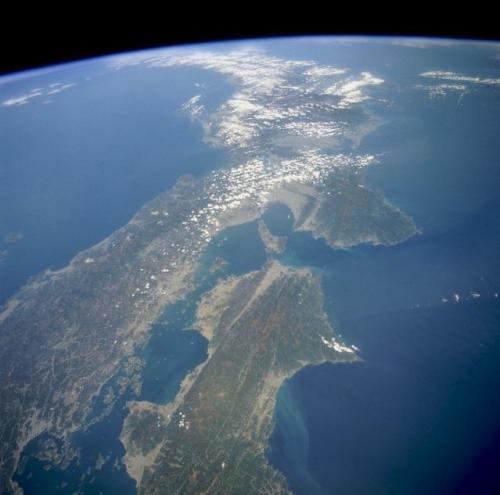
宇宙から中国地方と四国。

「 」
pixiv小説12周年表紙テンプレート描き下ろし
Here’s a new visualization technology I created in 2021. This is the Luminous Cartographic Display: a physical 3D map with internal illumination that creates realistic renderings of terrain, day and night cycles, environmental phenomena, and data visualizations. The physical 3D map display renders ‘pixel art’ animations created in blender, combining GIS data, lighting specific to days of the year, satellite images, and animation created with physics sprites and manual pixel-by-pixel editing. The piece was designed and fabricated by Tactile Terrain (me, James Tyrwhitt-Drake) with assistance from Metrographics Art + Design. It features the area around Waterton Lakes National Park in Alberta, Canada, and is on display at the Waterton Visitor Centre if you want to visit it. It is the most complex 3D map I have created to date. If you are curious about this piece or my other cartographic artwork, check out TactileTerrain.ca
-
 davvero-annoiatx liked this · 1 year ago
 -
 vjbgzs156 reblogged this · 2 years ago
 -
 vjbgzs156 liked this · 2 years ago
 -
 4xplay-or-2not reblogged this · 4 years ago
 -
 eqweqliao reblogged this · 6 years ago
 -
 tauganra liked this · 6 years ago
 -
 cielyr reblogged this · 9 years ago
 -
 luurrann reblogged this · 10 years ago
 -
 music-mistress liked this · 10 years ago
 -
 liraneffia liked this · 10 years ago
 -
 reyn-onni reblogged this · 10 years ago
 -
 theartofhiphopmusic reblogged this · 10 years ago
 -
 slunn reblogged this · 10 years ago
 -
 slunn liked this · 10 years ago
 -
 cherrybomb2 reblogged this · 10 years ago
 -
 threadbareteddybear liked this · 10 years ago
 -
 bootanist liked this · 10 years ago
 -
 hot-in-psychotic reblogged this · 10 years ago
 -
 leatherpearlslace reblogged this · 10 years ago
 -
 comandantzenac-blog liked this · 10 years ago
 -
 bernie-bear reblogged this · 10 years ago
 -
 ditwag reblogged this · 10 years ago
 -
 chopstickwarrior liked this · 10 years ago
 -
 ravenwinterwood reblogged this · 10 years ago
 -
 darkphoenixvica liked this · 10 years ago
 -
 the-queen-queer reblogged this · 10 years ago
 -
 hellsing15 liked this · 10 years ago
 -
 heychangalang reblogged this · 10 years ago
 -
 at0me reblogged this · 10 years ago
 -
 jeanbranche liked this · 10 years ago
 -
 intheeyeofadiamond liked this · 10 years ago
 -
 rtlppotatoes reblogged this · 10 years ago
 -
 consciousexpectations liked this · 10 years ago
 -
 empress1991 liked this · 10 years ago
 -
 library-user reblogged this · 10 years ago
 -
 femmeviva reblogged this · 10 years ago
 -
 femmeviva liked this · 10 years ago


